
SmartTrack – A Pocket Tool for Managing Production in the Field
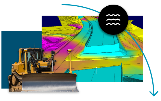
SmartTrack displays real time equipment tracks from 4D Sensors on a geo-referenced cut-fill grid map and provides current measure load counts, cycle lengths, cycle times, and equipment location.

Transform Earthwork Efficiency with SmartTrack’s Real-Time Insights
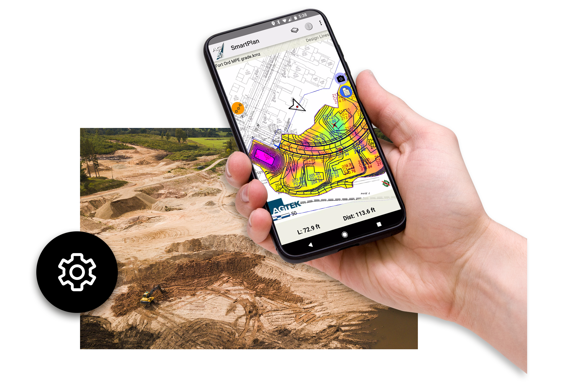
SmartTrack is a pocket-sized powerhouse for real-time field production management, designed to elevate your earthwork and grading projects. By leveraging 4D sensors, SmartTrack displays live equipment tracks on geo-referenced cut-fill grid maps or plan sheets, giving supervisors instant visibility into load counts, cycle lengths, cycle times, moving time, and stops. Its intuitive Plan mode simplifies stakeless grading—workers can easily mark grading limits, slope toes, daylight lines, and spoil piles. The app also measures areas and lengths, captures geotagged photos and notes, and syncs data with the office via a secure cloud connection. With this level of granular insight, field teams can make data-driven decisions on the fly, enhancing efficiency and transparency across job sites.
As an integral part of AGTEK’s production-smart software ecosystem, SmartTrack seamlessly feeds real-time machine movement and productivity data into broader earthwork workflows—bolstering bid precision, scheduling accuracy, and project profitability. Ideal for contractors who want to optimize haul planning, monitor equipment performance, and reconcile actual results against estimates, SmartTrack empowers field staff with actionable insights that improve productivity and drive smarter project outcomes. Compatible with both iOS and Android devices, SmartTrack ensures that your team stays connected, informed, and in control—directly from the point of action.

Features & Benefits
A pocket tool for managing field production
Displays real time equipment tracks from simple sensors
Provides measure of load counts, cycle lengths, cycle times, moving time and more
Measures areas and lengths
Records time-stamped photos, notes, and tracks
Delivers files to and from the office via a cloud server
Know exactly what is happening in the field in real-time
SmartTrack’s plan mode shows the user their position on the site plan or grid map for approximating the locations of plan features, marking grading limits, balance areas, slope toes and daylight lines, or documenting site features such as spoil piles and removals. Especially useful with stakeless grading. For as-builts, SmartTrack measures areas and lengths, records time-stamped photos, notes and tracks, and communicates files to and from the office by means of a cloud server on the cell network.
“SmartTrack has completely changed how we manage production in the field. Instead of guessing cycle times or relying on manual counts, we now have real-time visibility into equipment movement and haul progress. It’s streamlined communication between the office and the job site, saving us time and improving accuracy.”
–WL Contracting
Customer stories
Hear what our customers think about AGTEK.

WL Contracting – Working with SmartTrack
Hear how SmartTrack displays provide real time equipment tracking from simple 4D Sensors.

Ford Civil Engineering working with AGTEK
Nick Hughes from Ford Civil Engineering discusses their use of AGTEK with Peter Haddock.

Moving to AGTEK – Williams Dirt Services
Jenny Williams discusses her experience migrating to and working with AGTEK.
SmartTrack Frequently Asked Questions
SmartTrack is a mobile production‑management tool by AGTEK that uses 4D sensors to display real-time equipment tracks directly on geo‑referenced cut‑fill grid maps or plan sheets. It captures key metrics like load counts, cycle lengths, cycle times, moving time, stopping time, and equipment location.
SmartTrack is fully compatible with both iOS and Android smartphones or tablets, making it accessible and flexible for diverse field teams.
The app delivers live visibility into equipment movements, recording metrics such as cycle counts and times, stops, and movement durations. This granular insight enables real-time decisions and informs future bids, schedules, and equipment utilization.
SmartTrack’s Plan mode shows your exact position on the jobsite map, enabling users to mark grading limits, slope toes, daylight lines, balance areas, spoil piles, and more—ideal for stakeless grading workflows.
Absolutely—SmartTrack measures areas and lengths, records time-stamped photos and notes, and generates track logs. All files sync securely to the office cloud server via cell network for easy documentation and reporting.
SmartTrack uses a secure cloud server over the cellular network to sync data—everyone in the field and office sees the same up-to-date site progress and production metrics.

Training and Support at Your Fingertips
Get the most out of your AGTEK tools. Choose from web-based trainings or in-person classes for beginner, intermediate, or advanced learners. Our Community is here for you 24/7 with downloads, manuals, Tech Tips, and more.
Training and Support at Your Fingertips
Get the most out of your AGTEK tools. Choose from web-based trainings or in-person classes for beginner, intermediate, or advanced learners. Our Community is here for you 24/7 with downloads, manuals, Tech Tips, and more.
-
 Visit our Community
 -
 Schedule training
 -
 Contact us