
Highway Road Construction Software Imports DOT Survey and Design Files
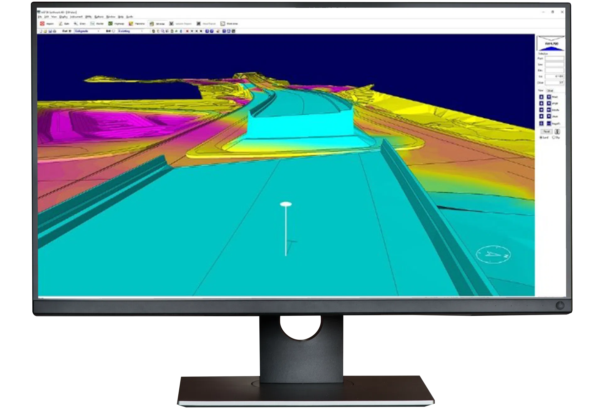
Highway takes job files and creates a 3D representation of the job that can be partitioned into the construction phasing required for traffic control and analysed as an interactive mass diagram.


Transforming Roadwork with Intelligent Takeoff
Highway is a purpose-built solution for heavy civil contractors who need to plan, estimate, and manage road and highway construction projects with precision and speed. It simplifies the complexities of linear infrastructure work by transforming traditional plan sets into intelligent, data-rich models that are easy to understand and share. Whether you’re estimating quantities, visualizing alignments, or coordinating with field teams, Highway gives you the clarity and control to make smarter decisions from day one.
Highway enables teams to extract alignments, cross-sections, and templates directly from digital plans, calculate earthwork and paving quantities with confidence, and visualize the entire project in 3D. Its seamless integration with field tools ensures that data flows smoothly from the office to the jobsite, improving communication and reducing costly errors. With support for a wide range of file formats and a user-friendly interface, Highway empowers construction professionals to deliver projects more efficiently, accurately, and collaboratively.

Features & Benefits
Create a 3D representation for volumetric analysis and construction phasing.
Identify balance intervals
Optimize locations for borrow and spoil
Calculate haul slopes
Differentiates dozer, scraper, and truck dirt
Review in Google Earth or georeferenced on a mobile device
Making Sense of Data
Bring your data to life with 3D visualizations and analytics to ensure projects are bid and constructed efficiently. Import road alignments, corridor models, and cross section data from design packages including CAD and PDF, or manually enter COGO and cross sections. AGTEK combines data from multiple sources, supporting all available DOT formats. Break data into construction phases, model material movement, and plan hauls with ease.

Mass Haul
Create intuitive mass diagrams and haul reports to show how to efficiently move material on linear projects. Determine in-station and alignment-station material movements. Calculate average haul lengths and haulage brackets. Fly drones for progress updates and calculate updated mass diagrams. Report how the dirt has moved and the most efficient way to finish the job.

Production Management
Utilize the power of drone imagery and point clouds to validate pre-bid site conditions and measure production progress during construction. Sync data to mobile apps and put actionable information in the Foreman’s hands to make faster informed decisions in the field. Calculate volumes and determine balance regions in the field to ensure you move the dirt once.
“One of the outstanding features of AGTEK is its ability to organize massive amounts of data into user-friendly formats, enabling teams to collaborate more efficiently and reduce redundant efforts in project management.”
—OHLA USA
Customer stories
How AGTEK has helped our customers.

OHLA USA working with AGTEK Highway
Dalin Smith from OHLA USA joins us to talk about their use of AGTEK, in particular the Highway module.

Chartway Civil Engineering an end to end AGTEK user
Seamus Foley from Chartway Civil Engineering joins Peter Haddock to share their use of AGTEK software.

Elder Corporation managing production with Trackwork
Shawn Swygman of Elder Corporation takes a deep dive into their use of AGTEK, specifically the Trackwork module.
Highway Frequently Asked Questions
AGTEK’s Highway program is a specialized takeoff and modeling tool designed for road and highway construction projects. It helps contractors quickly calculate earthwork volumes, model complex road alignments, and generate accurate 3D surfaces for estimating and field production.
The Highway program streamlines Department of Transportation (DOT) bids by importing alignments, templates, and cross sections directly from CAD or XML files. It calculates accurate cut/fill quantities and material layers in minutes, ensuring your highway estimates meet DOT specifications.
Yes. The program can model multiple alignments, ramps, and intersections simultaneously—ideal for interchanges, frontage roads, or multi-phase projects—so you can calculate total quantities across complex roadway systems.
Gradework is AGTEK’s general earthwork takeoff and modeling software for all types of sitework. Highway extends that capability for linear, station-based projects—adding powerful alignment, template, and section management tools tailored to road construction.
The software automates template building, cross-section generation, and mass haul analysis—allowing estimators to complete detailed highway takeoffs in a fraction of the time compared to manual methods, while reducing human error.
Yes. Highway includes built-in mass haul diagrams and balance optimization tools, helping you minimize haul distances, optimize borrow/waste, and plan efficient earthmoving operations.
Yes. You can import drone-derived surfaces or GPS topo data as background models, compare design vs existing conditions, and calculate accurate volumes for as-built verification or progress tracking.


Training and Support at Your Fingertips
Get the most out of your AGTEK tools. Choose from web-based trainings or in-person classes for beginner, intermediate, or advanced learners. Our Community is here for you 24/7 with downloads, manuals, Tech Tips, and more.
Training and Support at Your Fingertips
Get the most out of your AGTEK tools. Choose from web-based trainings or in-person classes for beginner, intermediate, or advanced learners. Our Community is here for you 24/7 with downloads, manuals, Tech Tips, and more.
-
 Visit our Community
 -
 Schedule training
 -
 Contact us