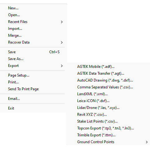
The Export command is used to export all data types other than Gradework ESW and ESZ format.. Below is a description of all the different file types that may be exported.
Displays the Export drop-down menu with all the available file types.

The following file types may be exported.
AGTEK Mobile Files |
(*.adf) ) |
File type used in AGTEK mobile Apps SmartDirt and SmartGrade |
AGTEK Data Transfer |
(*.agt) |
AGTEK text format used for transferring data from one Earthwork file to another |
AGTEK EarthWork 3D Compatible |
(*.esw) |
AGTEK Earthwork 3D compatible file format |
AutoCAD Drawing |
(*.dwg, *.dxf) |
File type used for transferring data to third party CAD and machine control software |
Comma Separated Values |
(*.csv) |
Text file used for transferring point data to other applications. Format is P,N,E,Z,D |
KMZ Export |
(*kmz) |
Google Earth file format. File type used in AGTEK mobile app SmartPlan |
LandXML |
(*.xml) |
File ype used for transferring surface and alignment data to third party applications and machine control software |
Leica iCON |
(*.dxf) |
File type used in in Leica machine control software |
Lidar Drone |
(*.las, *.xyz) |
File type used for transferring drone point cloud data to third party applications. |
Revit XYZ |
(*.csv) |
File type used to transfer data to AutoDesk Revit |
Stake List Points |
(*.csv) |
File type used to export the AGTEK Stake List to a text file for third party survey applications. |
Topcon Export |
(*tn3, *.ln3) |
File types used in Topcon machine control software |
Trimble Export |
(*.ttm) |
File type used in Trimble machine control software |
VRML Export |
(*.wrl) |
File type used in third party virtual 3D views |
Select the file type from the drop-down list.
Type in a different name if desired in the text box. Press the Save button to save the file.