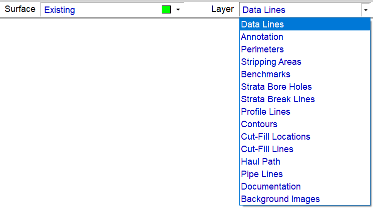
The Existing Surface is composed of several layers. The example below shows the available Existing Surface Layers. A brief explanation about the layers is found below.

Data Lines |
The Data Lines layer contains the lines, points and labels relevant to the existing ground. Data contained within this layer is used to generate the 3D surface. |
Annotation |
2D information not used to form the 3D surface. 2D CAD Data is automatically moved to this layer during transfer. |
Perimeters |
Used to define the bounding edge of the existing ground data. |
Stripping Areas |
A modifying layer used to indicate areas where vegetation and topsoil is removed prior to starting the design. Stripping Areas modify the Existing and form the Stripped Surface. |
Benchmarks |
Contains any control points (Benchmarks) specified. These points are often used for re-scaling to plansheet or with AGTEK's Graphic Grade program. |
Strata Bore Holes |
Points used as boring to describe Strata layers as depths below the existing ground or by elevations that cannot exceed the existing ground. |
Strata Break Lines |
Break Lines area used to connect the bore holes which help the program determine the strata between the bore holes. |
Profile Lines |
Used to create profiles and cross sections across the job. This lines are also used to create stations and offsets. |
Contours |
Lines created when using the Contour Surface command from the Utility Menu in Edit Mode. |
Cut/Fill Labels |
These are spots entered to be used in conjunction with the User Cut Fill Values located under the View Menu in Planview Mode. |
Cut/Fill Lines |
Lines that define the boundary of the cut and fill areas on the job. These lines are placed according to the Edit Cut-Fill Transition value. |
Haul Path |
These lines are generated when calculating Balance Regions. The line runs from the center of mass of cut to the center of mass of fill. |
Pipe Lines |
These lines are entered to calculate the trench volumes. |
Documentation |
Contains user added Notes or 3D Notes entered in Sitework 4D or Notes and Photos imported from SmartPlan. |
Background Images |
Contains the sheet borders for imported PDF and TIF files. |