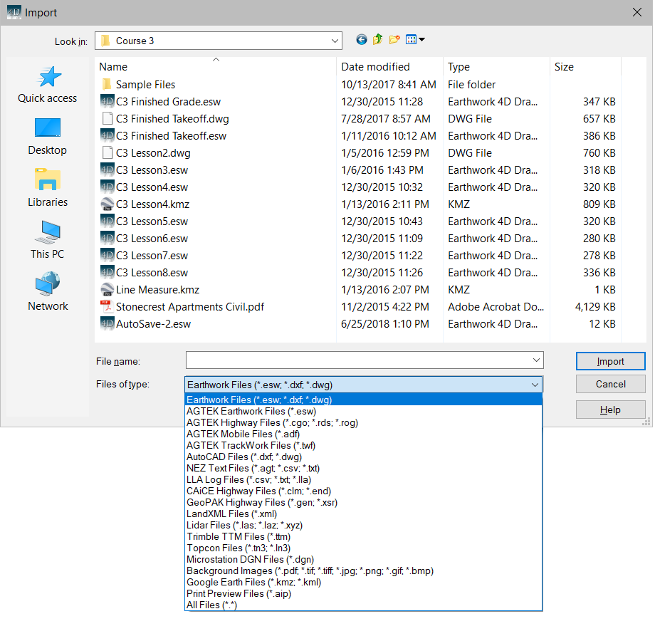
Earthwork 4D can import a variety of file types. Below is a list of available file types which can be imported.
Earthwork Files |
(*.esw, *.dxf, *.dwg) |
AGTEK SiteWork Files |
(*.esw) |
AGTEK Mobile Files |
(*.adf) |
AutoCAD Files |
(*dxf, *.dwg) |
NEZ Text Files |
(*.agt, *.csv, *.txt) |
LandXML |
(*.xml) |
Trimble TTM Files |
(*.ttm) |
Topcon Files |
(*.tn3, ln3) |
Microstation DGN Files |
(*.dgn) |
Backgraound Images |
(*.pdf, tif, tiff, jpg, png, gif, tmp) |
Google Earth Files |
(*.kmz) |
Print Preview Files |
(*.aip) |
Importing begins by selecting Import from the File menu or by choosing the Open from the File menu. When selected the Open window displays.

Use the drop-down menu to choose the desired file type. All files with the selected type display in the window. Select the file and press the Open button.
![]()
Earthwork Files (.esw)
ESW files are generated by Earthwork 4D.
![]()
AutoCAD Files (.dwg, dxf)
AutoCAD files all open using Import Mode. All available CAD files (.dxf and .dwg) in that directory appear in the window. Change the directory path and select the file from the list in the window. The name then displays in the File Name text box. Press the Open button to get the file. The screen switches to Import mode allowing you to transfer the data to the appropriate surface. Select the data and transfer it to the corresponding surface and layer. Go to Import Mode for more information on transferring data.
![]()
AGTEK Mobile Files (.adf)
AGTEK mobile files are generated from AGTEK Sitework 4D. ADF files are used with SmartDirt and SmartGrade.
![]()
NEZ Text Files (.agt, .txt, csv)
Text files containing points with the format Point Number, Northing, Easting, Elevation, Description. File may be comma, space or tab delimited. AGT files are generated by AGTEK software.
![]()
LandXML Files (.xml)
LandXML files may contain surface data or alignments. The surfaces may contain boundaries, contours, breaklines or a trimesh. Alignments may contain horizontal geometry, vertical geometry or cross sections.
![]()
Trimble and Topcon Files (.ttm, .tn3)
TTM (Trimble) and TN3(Topcon) are trimesh files. If the existing surface is created first, and then the TTM or TN3 file is read, the design surface will not update. The triangle mesh displays what was read from the file and 3D View can be entered to display the Cut/Fill. Any editing of the surface will cause AGTEK to re-write the triangular mesh which was just imported. The data in these files will over-write any existing data in the current surface layer.
![]()
Microstation DGN Files (.dgn)
Microstation files all open using Import Mode. All available Microstation files (.dgn) in that directory appear in the window. Change the directory path and select the file from the list in the window. The name then displays in the File Name text box. Press the Open button to get the file. The screen switches to Import mode allowing you to transfer the data to the appropriate surface. Select the data and transfer it to the corresponding surface and layer. Go to Import Mode for more information on transferring data.
![]()
Backgraound Images (*.pdf, tif, tiff, jpg, png, gif, tmp)
Background images may be imported to complete an earthwork takeoff. PDF files may contain vector data that may be used to quickly assign elevations to the data lines.
![]()
Google Earth Files (*.kmz)
KMZ files may be imported containing data saved from Google Earth or SmartPlan. Files saved with SmartPlan may contain photos, notes, tracks or measure areas.
![]()
Print Preview Files (.aip)
Importing an AIP file automatically switches the program over to the Print Preview Page. Any reports or images already on the Print Preview Page remain and the imported .aip file adds to the page.
![]()