
Reveal Maps: Streamlined Photogrammetry Meets AI
Harness the power of photogrammetry and AI to streamline your RTK drone data workflow.


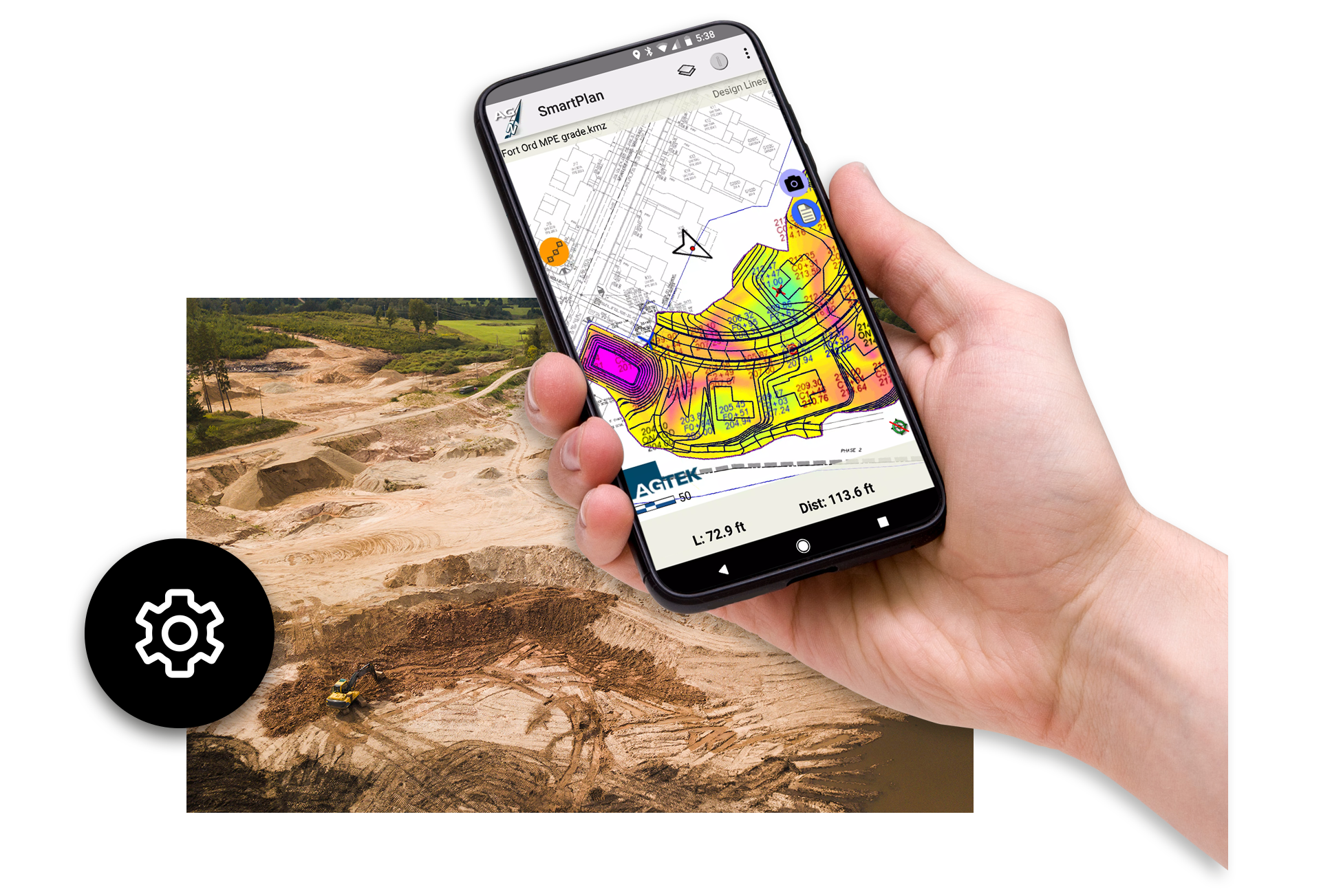
Drone Mapping and AI-Powered Photogrammetry for Heavy Construction
Reveal Maps revolutionizes how contractors capture and process site data by combining RTK drone technology, photogrammetry, and AI-driven workflows. Designed for heavy civil projects, Reveal Maps transforms aerial imagery into precise 3D point clouds and orthomosaic maps with simple, verifiable processes. Just drag and drop your drone photos, and Reveal Maps delivers accurate surfaces aligned to real-world coordinates—ideal for earthwork takeoffs, grading plans, and progress tracking. This streamlined approach eliminates reliance on third-party services, giving you full control over your data and faster turnaround times.
When paired with Reveal Clean, the platform automatically classifies and removes heavy construction objects like machinery and stockpiles, producing clean bare-earth models for volume calculations and site planning. Reveal Maps integrates seamlessly with AGTEK’s Gradework, enabling contractors to optimize grading, validate existing conditions, and share consistent deliverables across teams. By leveraging cutting-edge drone mapping and AI technology, Reveal Maps helps you bid smarter, reduce risk, and make confident decisions throughout the construction lifecycle.

Features & Benefits
Reveal Maps creates highly accurate point clouds and orthomosaics from aerial imagery.
Intuitive, simple workflow optimized for civil construction
Visual and numeric confirmation of control points for accuracy confidence in resulting maps and point clouds
Works with RTK drones for capturing data to ensure accurate and simple data capture
Integrates seamlessly with Reveal Clean, Gradework and Materials allowing for smooth transfer of data between platforms
Extensive training resources and customer support to maximize the software’s potential

Simple, Verifiable Drone Models for Heavy Construction
Reveal Maps creates 3D point clouds and orthomosaic maps from your RTK drone flights with simple, intuitive, verifiable workflows. Simply drag your photos in, press a button, and compare the results both visually and numerically for high confidence in surface quality.
Paired with Reveal Clean, the resulting point cloud is separated using AI into Heavy Construction objects that can easily be removed or edited to quickly give bare earth models for volumes and planning in Gradework.

The Reveal Workflow
AGTEK recommends the Mavic 3E drone, a versatile commercial drone equipped with a mechanical shutter, rapid interval shooting camera, and an RTK module for centimeter-level precision. Paired with the Mavic 3E Pro remote controller and the integrated DJI Pilot 2 software, flight planning becomes a seamless process.
- Drag and drop the images gathered into Reveal Maps.
- Reveal Maps automatically process the data to calculate a point cloud and an orthomosaic TIFF.
- Reveal Clean efficiently classifies items on your job site, from categorizing materials to identifying heavy machinery.
- Reveal Maps verifies localization. Known survey points are established, aligning the point cloud and orthomosaic imagery with the job site’s specific coordinates.

Artificial Intelligence Provides Clean Data
These streamlined processes ensure a high degree of accuracy and allow for precise mapping, planning, and decision-making on your construction projects.
Bringing together cutting-edge drone technology, advanced AI, and intuitive software, AGTEK’s Reveal platform presents an unmatched solution to effectively and efficiently manage your construction site data.
“By leveraging AI-powered automation, Reveal helps our team efficiently remove noise and irrelevant elements from drone and laser scan data—saving time and improving the accuracy of our digital models. This shift to smarter data processing allows us to focus more on analysis and decision-making, rather than manual cleanup.”
-D.W. White Construction
Customer stories
Hear what our customers think about AGTEK.

D.W. White Construction – Working with AGTEK Reveal
D.W. White recently started working with AGTEK Reveal, which helps them clean up point cloud data with the use of AI.

Goodfellow Bros working with AGTEK
Ken Fritts, the Takeoff Manager at Goodfellow Bros, talks about how they are using AGTEK.

Moving to AGTEK – Williams Dirt Services
Jenny Williams discusses her experience migrating to and working with AGTEK.
Reveal Maps Frequently Asked Questions
Reveal Maps is a drone mapping and photogrammetry solution for heavy construction projects. It converts aerial imagery into accurate point clouds and orthomosaic maps for earthwork planning and progress tracking.
Simply upload your drone photos, and Reveal Maps uses AI-powered photogrammetry to generate precise 3D surfaces aligned to real-world coordinates.
Reveal Maps produces high-resolution orthomosaic maps, point clouds, and terrain models for grading optimization, site balancing, and machine control.
Yes, Reveal Maps is optimized for RTK drone workflows, ensuring accurate georeferenced surfaces without the need for complex manual adjustments.
Absolutely. Reveal Maps integrates seamlessly with AGTEK Gradework and Reveal Clean for complete earthwork modeling and takeoff workflows.
By generating clean, accurate surfaces from drone imagery, Reveal Maps enables precise volume calculations and reduces guesswork in estimating.
Reveal Maps gives contractors full control over their data, faster turnaround times, and cost savings by eliminating reliance on external providers.

Training and Support at Your Fingertips
Get the most out of your AGTEK tools. Choose from web-based trainings or in-person classes for beginner, intermediate, or advanced learners. Our Community is here for you 24/7 with downloads, manuals, Tech Tips, and more.
Get in touch with our team
Let us know if you have questions about AGTEK sales, training, or products. A representative will be in touch soon.
-
 Connect with an AGTEK expert
 -
 Get your questions answered fast
 -
 Schedule a strategy call
 -
 Start winning more jobs with AGTEK