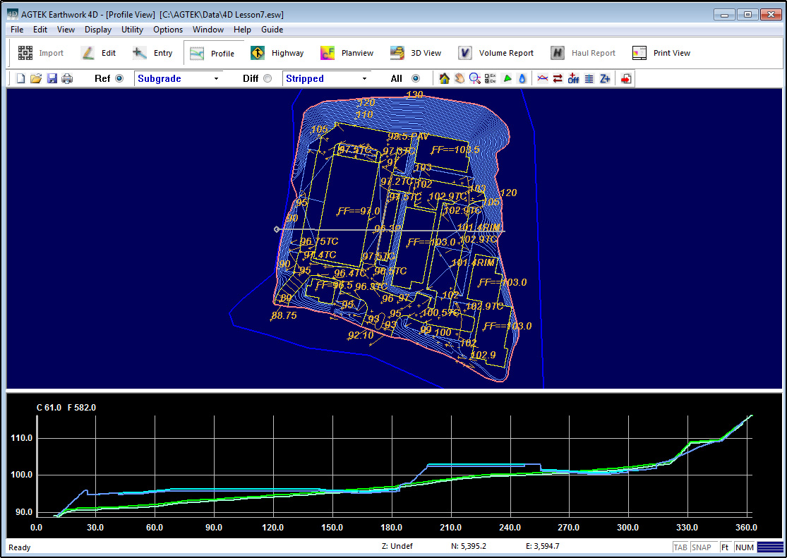
Profile View is the mode where you may view user defined profiles through the site. Below is a general description of attributes found on these screens.

Overlay
The Overlay is the two-dimensional plan view of the data. The overlay data is color coded by its Earthwork 4D layer. Light Blue represents Design Surface Data Lines which have elevation and are used to create the 3D surface. Green represents Existing Surface Data Lines used to create the 3D Surface. Brown represents the Annotation Lines which have no elevation and are not used to form the 3D surface. Data in layers being transferred from CAD Transfer Mode is automatically sent to the Annotation layer if it has no elevation. Typing O on the keyboard toggles the display of the overlay. Typing T toggles the display of the cut/fill shading.
![]()
Selection Toolbar
![]()
The toolbar allows you to switch to different modes, print, save files, and choose the Reference (Ref) and Difference (Dif) surfaces for comparison. Also see: Selection_Toolbar and Surfaces.
![]()
Utility Toolbar
The displayed functions on the Utility Toolbar change according to which mode you are in. Also see: Utility_Toolbar
![]()
Profile
The Profile displays the cross section of the profile line currently selected on the overlay. The existing ground is represented by the Green line, the design by Light Blue and the strata layers by Red lines.
![]()