




Matrice 4E Drone
The Matrice 4E drone brings construction site mapping and mission efficiency to new heights, seamlessly integrating into AGTEK’s construction workflow.


Secure, Accurate Aerial Mapping for Construction: Powered by Matrice 4E
The Matrice 4E drone is purpose-built for surveying and construction. It pairs a 20 MP 4/3 CMOS wide camera with a mechanical shutter for distortion-free imagery, along with an integrated RTK module that delivers centimeter-level positioning accuracy. With flight times of up to 49 minutes, mapping speeds of up to 21 m/s, and O4 Enterprise transmission range of up to 25 km, the Matrice 4E lets crews cover large job sites in fewer flights while maintaining survey-grade precision.
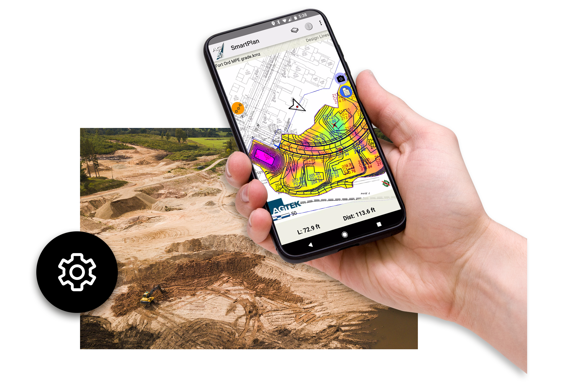
AGTEK uses the Matrice 4E drone as part of its construction software and digital takeoff workflows. Contractors using AGTEK rely on accurate site information to estimate quantities, plan earthmoving, and manage costs. Data collected by the Matrice 4E can be processed into aerial maps and surface models that work directly with AGTEK tools such as Gradework, Materials, SmartPlan, and SmartDirt. This helps estimators calculate cut-and-fill volumes more accurately and create stronger, more competitive bids.
The Matrice 4E is also valuable during active construction. Its 0.5-second interval shooting and onboard Smart 3D Capture let crews fly regularly to track job progress, compare planned versus actual conditions, and identify problems early. When this drone data is combined with AGTEK’s analysis and reporting tools, project teams gain a clearer understanding of production rates and site performance.
By integrating the Matrice 4E drone with AGTEK construction software, contractors can improve accuracy, reduce risk, and make better decisions. This combination supports key SEO topics, including drone mapping for construction, earthwork takeoff software, and aerial data for civil construction projects.
Features & Benefits
The Matrice 4E features a mechanical shutter, rapid interval shooting, an RTK module for centimeter-level precision, and O4 Enterprise transmission with up to 25 km of range.

Accurate validation of site conditions and tracking production progress

Provides insights into what work needs to be done

Captures detailed data with greater ease and safety than conventional surveying

SmartApps enable volume calculations on the fly

See the orthophoto and updated cut/fill maps of the site on your mobile device

Smart 3D Capture generates rough 3D models and mapping routes directly on the remote controller

It all starts with a drone
AGTEK recommends the Matrice 4E, a versatile commercial drone equipped with a mechanical shutter, rapid interval shooting camera, and an RTK module for centimeter-level precision. Paired with the DJI RC Plus remote controller and the integrated DJI Pilot 2 software, flight planning becomes a seamless process.
Simply tap around the project area, specify the flight parameters, and launch the drone. It will autonomously fly its pre-determined path, capturing high-resolution images every half-second, which are stored on a removable microSD card. Once the mission is complete, the drone returns home automatically, ready for data processing back at the office.

Processing drone data
The point cloud file contains a data point about every inch across the entire site. This orthoimage provides valuable insight into what has been put in the ground and what remains. The length of pipe, the amount of base material, the length of curb can all be calculated in AGTEK with simple tools that measure project progress.

Enhance construction site production tracking and safety
Drones are fast and effective for accurate validation of site conditions, tracking production progress and providing insights into what work needs to be done and what has been completed. When drone data is collected in the right way, the results are very detailed, accurate and can be captured with greater ease and safety compared to conventional surveying.
“Drone flights capturing high‑resolution site data have significantly reduced manual processing time and enhanced collaboration between field and office teams.”
— Firethorn Construction
Customer stories
How AGTEK has helped our customers.

D.W. White Construction – Working with AGTEK Reveal
D.W. White recently started working with AGTEK Reveal, which helps them clean up point cloud data with the use of AI.

WL Contracting – Working with SmartTrack
Hear how SmartTrack displays provide real time equipment tracking from simple 4D Sensors.

Ford Civil Engineering working with AGTEK
Nick Hughes from Ford Civil Engineering discusses their use of AGTEK with Peter Haddock.
Matrice 4E Drone Frequently Asked Questions
The Matrice 4E is DJI’s flagship enterprise mapping drone, designed for construction, surveying, and mining projects. It delivers accurate aerial mapping and integrates seamlessly with AGTEK software for efficient site management.
By capturing high-resolution aerial data and generating precise topographic models, the Matrice 4E reduces field time, improves accuracy in quantity calculations, and speeds up decision-making for project managers.
The drone is ideal for civil engineering, earthwork contractors, infrastructure development, and any industry requiring accurate site mapping and progress tracking.
Yes, the Matrice 4E is fully compatible with AGTEK’s earthwork takeoff and modeling tools, allowing users to process drone data quickly and efficiently. It captures high-resolution aerial imagery and topographic data, which can be imported directly into AGTEK Reveal for creating accurate 3D models, contour maps, and earthwork calculations.
It captures high-resolution imagery from its 20MP wide camera, and topographic data for creating 3D models, contour maps, and accurate volume calculations.
The Matrice 4E provides survey-grade accuracy with its built-in RTK module (1 cm + 1 ppm horizontal), and even higher precision when paired with proper ground control points and AGTEK’s advanced processing tools.
Yes, the drone is designed for ease of use with automated flight planning, Smart 3D Capture, and intuitive controls, making it accessible for both beginners and experienced operators.
Drones like the Matrice 4E save time, reduce labor costs, improve safety, and deliver more accurate data compared to traditional surveying methods.
Data captured by the Matrice 4E can be processed in AGTEK software within hours, enabling rapid updates to project models and progress reports.

Training and Support at Your Fingertips
Get the most out of your AGTEK tools. Choose from web-based trainings or in-person classes for beginner, intermediate, or advanced learners. Our Community is here for you 24/7 with downloads, manuals, Tech Tips, and more.
Ready to see AGTEK’s construction takeoff software in action?
We’re happy to walk you through it, whether that’s a full product demo or a quick strategy call to talk through your workflow. Let us know what you’d like to see, or what questions you have about training and products, and we’ll be in touch.
-
 Connect with an AGTEK expert
 -
 Get your questions answered fast
 -
 Schedule a strategy call
 -
 Start winning more jobs with AGTEK