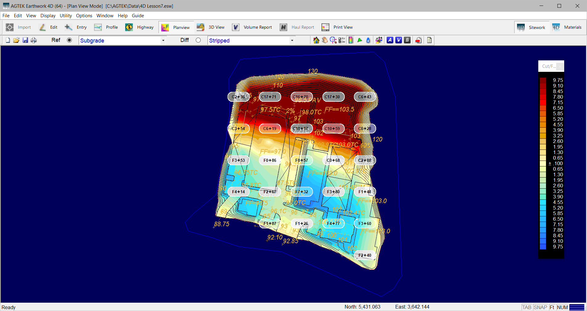
Planview is the mode where the user can view the cut/fill shade map along with cut/fill labels, enter Balance Regions, and attach elevations from Profiles. Below is a general description of attributes found on these screens.

Planview
The Planview is the two-dimensional cut-fill shaded plan view of the data. The planview labels and Cut/Fill shade table can be displayed by selecting options located under the Display menu. The Shade Table can be displayed by selecting it under the Display Menu. Typing O on the keyboard toggles the display of the overlay. Typing T toggles the display of the cut/fill shading.
![]()
Selection Toolbar

The toolbar allows you to switch to different modes, print, save files, and choose the Reference (Ref) and Difference (Dif) surfaces for comparison. Also see: Selection_Toolbar and Surfaces.
![]()
Utility Toolbar
The displayed functions on the Utility Toolbar change according to which mode you are in. Also see: Utility_Toolbar
![]()