
The Dirt.Simple Express - March 2024
Building Relationships Coast to Coast
AGTEK is hitting the road this year, visiting customers in the regions where they do business. We’re sitting down with a select group of valued contacts in key markets to listen to their thoughts on the construction industry, the challenges they face, and the tools they are using to help them manage their businesses.
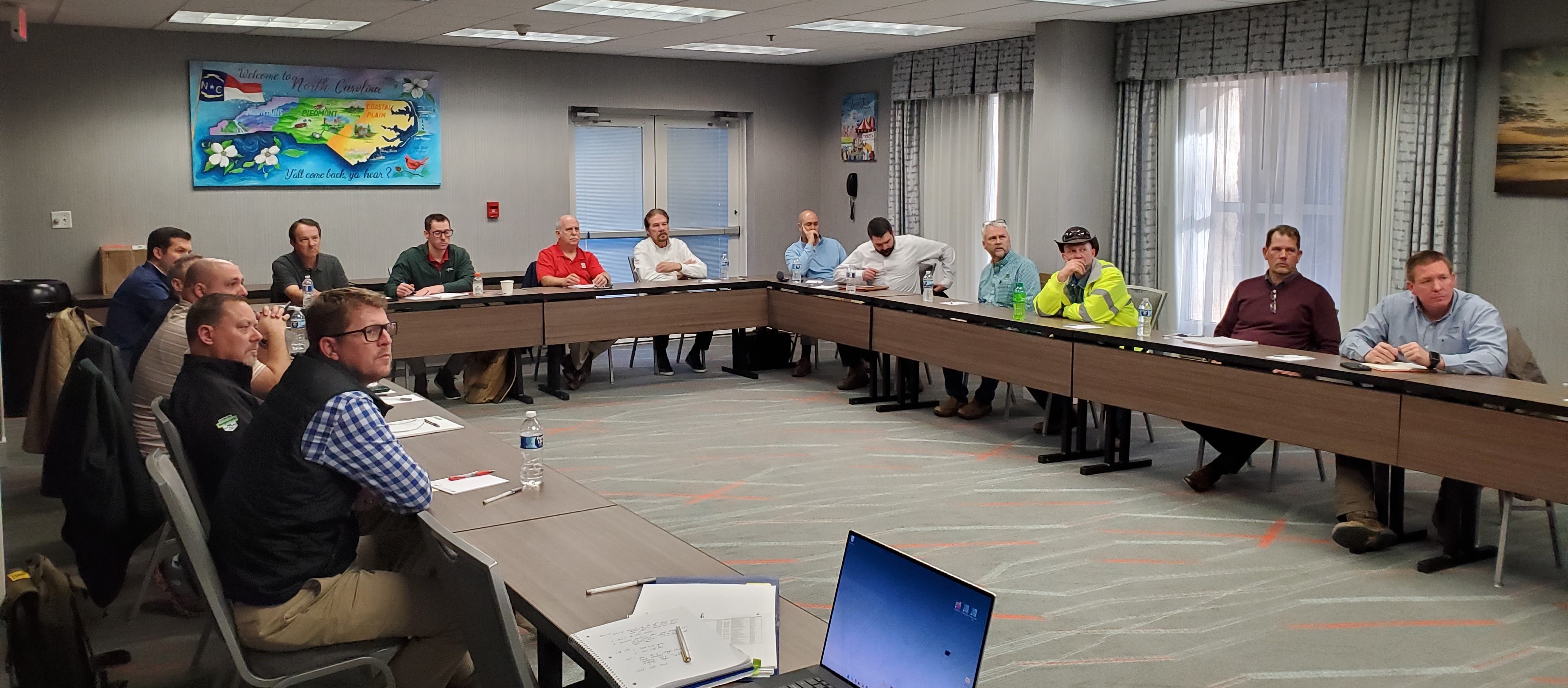
These meetings allow us to tell customers more about all the solutions AGTEK has to offer and introduce them to our parent company, Hexagon. We are able to provide a deep dive into our current tools, talk about what’s coming, and share our vision and roadmap for the future. In return, we receive feedback to help us shape how AGTEK solutions are developed, delivered, and priced in the future.
We tested this meeting format out in 2023 at Hexagon Live in Las Vegas, and the positive feedback we received from our guests prompted our decision to expand the event nationwide. We started this year’s tour in the Southeast, with stops in Raleigh, Nashville, Tampa, and Atlanta. Our next road trip will take us to Dallas, Kansas City, Chicago, and Philadelphia. A West Coast trip is in the works for later this year. We plan to visit eleven markets in total.
We hope these meetings illustrate how much we value our customer’s feedback and continuously funnel it into our product development so that we can continue to provide the innovative tools they need to work faster and more efficiently.
Top 10 Reasons to Use Drones on Earthwork Projects
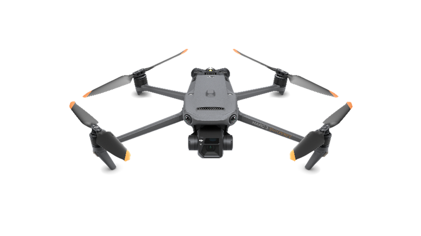
Is drone data really that helpful for dirt contractors? We think so, and here are 10 ways to use it:
1) Validate Existing Conditions
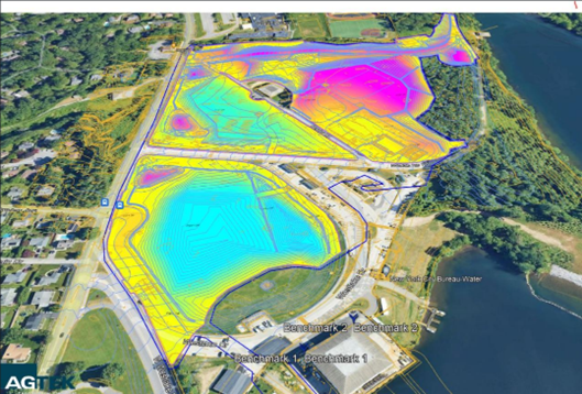
A drone point cloud can quickly be compared to the original ground map used to bid the job to evaluate if anything has changed since the existing ground survey. Plus, the high-resolution orthophoto documents the site so both you and the project owner can truly see current conditions. AGTEK’s REVEAL takes the data collected from your drone and automatically classifies and removes unwanted elements, providing clean, exact data in a fast, simple process leveraging the power of AI, saving you time and money.
2) Estimate Demolition Quantities
Once you’ve imported your drone map into Gradework, you can use it to quantify and validate demolition quantities on existing buildings, asphalt, concrete, and vegetation. Or use drone data to fill in where demo plans are incomplete or unavailable.
3) Site Organization and Planning
You can fly a site much faster than you can do a GPS topo and the drone data gives you a more detailed point cloud and aerial photo so that you can accurately haul plan, identify balance regions, and know where to stockpile materials.
4) Keeping Score – Quantify Earthwork Progress
Progress happens quickly and drone data will help you track it without tying up your GPS system. Compare your updated map to the existing ground survey (or your last drone flight) to see how much dirt you have moved to date or to your subgrade model to see how much you have left to do. Validate and calibrate the compaction factors for shrink and swell.
5) Visual Inspection
You know the saying, “a picture is worth a thousand words”? Well, it is just as true for job site documentation, progress monitoring, and haul route verification. You can also take visual inspection to the next level by measuring lengths, areas, and counts – both for what’s in place and for what remains – to easily assess and quantify material procurement needs.
6) Collaboration, Communication, Documentation
Drone data can be shared with the owner, designer, engineer, and project team allowing for streamlined communication, even with those who are not able to be present on site. It improves internal communication because the data is easily relayed between the office and the field through AGTEK’s SmartDirt mobile app. The point cloud data and photographs create clear documentation of site conditions for use in change order negotiations, claims, and disputes.
7) Stockpile Quantities and Quarry Management
Drones make it quick and most importantly safe to get very accurate stockpile volumes or quarry inventory quantities.
8) Independent Grade Checks
Measure twice, cut (or fill!) once.
9) Progress Updates and Project As–Builts
Use Gradework to share the current drone map with owners, developers, and your project team. AGTEK makes it easy to export .kmz files which can be opened in Google Earth or in your AGTEK mobile apps to use onsite. Once the project is complete, you can use the drone to capture as-built information and identify utility tie-in points and other relevant information for the follow-on contractor or project owner.
10) Drone Data + Equipment Tracks
When you combine your drone data with equipment tracks you can start analyzing production because you can measure what has changed and see why!
Want to learn more? Email us at sales@agtek.com.
Hexagon’s New Building Solutions Group Connects Customers to Integrated Tools

AGTEK’s parent company, Hexagon, recently announced the formation of Hexagon Building Solutions, which has created new workflow packages that automate the capture and analysis of construction progress and verification data. The workflows were created to help construction companies realize the benefits of their tech investments by leveraging Hexagon's deep industry expertise, breadth of software and hardware solutions, and extensive network of local partners.
The service launch was announced in Dallas, TX, where Hexagon is utilizing the new workflows as proof of the transformative potential of innovative digitization solutions in a real-world setting. Three integrated workflows leverage the combined power of Hexagon's construction portfolio brands¬--Leica Geosystems, Multivista, OxBlue, Projectmates, AGTEK, and Bricsys, which all have a robust local presence and deep roots in Dallas.
Hexagon’s consultative service aims to become a trusted technology partner that helps customers bridge gaps, drive efficiency, and facilitate seamless communication. A four-step program guides general contractors and owners toward the optimal workflow that combines the best hardware and software solutions for their project needs.
Hexagon's Building Solutions experts collaborate with customers throughout the discovery, recommendation, and deployment phases and provide continued support until the project is completed. If you would like to learn more, read the press announcement, here.
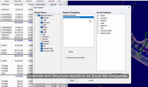
Tech Tip Video: Exporting to HCSS
Gradework/Materials/Underground has added the ability to export the materials and structure report to an Excel file compatible with your HCSS estimating software. Watch the video
February’s LinkedIn Contest Winners
Thanks to everyone who entered our AGTEK-branded Carhartt jacket giveaway. This was our most competitive giveaway yet, with a lot of entries. Congratulations to the grand prize winner, Michael Barbosa of Schiavone Construction Company. We liked the entries we received so much that we decided to give away a few of our cool AGTEK hats as runner-up prizes. Those went to Jess Coonrod of Austin Bridge & Road and Brent Feeley of Teichert Construction. We appreciate you sharing examples of your work. It’s great to see how AGTEK's dirt simple mpsolutions help you complete your work every day.
Take the Next Step with AGTEK Training

Getting your team to up to speed using AGTEK is the best way to optimize your investment in the tools. Our spring classes are nearly full, but we will be listing our summer and fall classes soon! You can find training dates on our website as soon as they are announced.
Our Beginning/Intermediate courses are hands-on. Each user has a computer and will have the opportunity to perform tasks and follow processes along with an experienced instructor and the other students. Users will jump in and learn how to do interactive takeoff, modeling, integrate drones into their workflow, and manage production tracking. This class is best for those new to AGTEK and those who are looking to deepen their knowledge of the tools.
Our Intermediate/Advanced training sessions are seminar-style and focus on best practices using our integrated tools for earthwork, underground, and materials takeoff. Students will not have a computer. They are encouraged to take notes and join the discussion and will learn tips to work smarter and more efficiently from the AGTEK experts. This course moves fast and is best for those with some AGTEK experience.
Visit our website to get an overview of each day’s lesson. Take all three days for a comprehensive look at our workflow. Individual days may be taken based on availability. Breakfast and lunch are provided daily. We hope to see you in class!
Be Social, Follow Us
>
We have expanded our presence on social media, and we hope to connect with you wherever you like to scroll. Make sure to follow us as we share product updates, upcoming events, feedback from our customers, introduce you to our talented team, and much more! Keep an eye out for our special Q1 LinkedIn promotion where you could win a special AGTEK prize.
 Facebook
  Instagram
  Twitter-X
Get current versions
To download the latest desktop versions, AGTEK support subscribers can go to Support - Downloads and click the name of the program they wish to download. When the download is complete, click the filename to install. If Windows "protects" your PC, click "More Info", then "Run Anyway" and follow the install directions to complete the installation. (To check your program version, open the program and select Help > About "program name".
To update mobile apps for iOS devices, go to App Store and click Updates. For Android devices, go to Google Play and search AGTEK.


 Contact Us